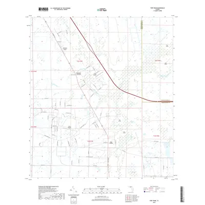
2018 Map of Fort Drum
USGS Topo · Published 2018About this map
Fort Drum and Osowaw Junction anchor this landscape in Okeechobee County, where the transition between dry prairies and low-lying wetlands is clearly defined by local hydrology. The area is intersected by a network of drainage features and slow-moving waters, including Fort Drum Creek, Jim Green Cr, and the braided Hogskin Slough. These waterways navigate around elevated landforms such as Bear Island and Arch Island, which stand out within the surrounding Sawgrass Bay and Pumpkin Bay.
Find a feature on this map
97 named features on this map. Tap any name to fly to it.
Don’t see what you’re looking for? This feature index may not catch every label — zoom into the map to look around manually.
Map Details
Editions of this 2018 Fort Drum Map
This is the sole edition of this map. No revisions or reprints were ever made.
Other maps of this area

1953 · Taylor Creek NW
USGS Topo · 1:24,000

1953 · Fort Drum
USGS Topo · 1:24,000

1953 · Fort Drum SW
USGS Topo · 1:24,000

1953 · Fort Drum NW
USGS Topo · 1:24,000

1953 · Fort Drum NE
USGS Topo · 1:24,000

1953 · Fellsmere 4 SW
USGS Topo · 1:24,000

1953 · Fellsmere 4 NW
USGS Topo · 1:24,000

1953 · Taylor Creek NE
USGS Topo · 1:24,000

1953 · Okeechobee 1 NW
USGS Topo · 1:24,000

1956 · Fort Pierce
USGS Topo · 1:250,000