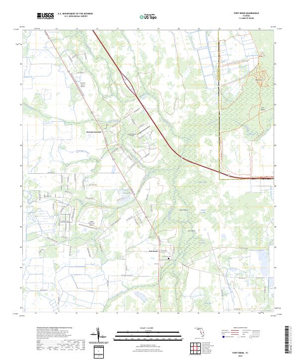
2024 Map of Fort Drum
USGS Topo · Published 2024About this map
Fort Drum and the surrounding marshlands of central Florida define this landscape, where the interplay of water and rural transit is evident in the numerous sloughs and branches. The small settlement at Osowaw Junction serves as a key point near the northern reach of the quadrangle, while the historic Fort Drum Cem provides a focal point for genealogical research in the area. The terrain is characterized by intricate water systems such as Parker Slough, Gum Slough, and Boggy Branch, which feed into larger features like the Fort Drum Marsh Conservation Area. The presence of several local airstrips, including Russakis Ranch Airport and Indian Hammock Airport, suggests a reliance on light aircraft for traversing this low-lying environment. Landforms like Bear Island and Arch Island rise slightly above the wetlands, marking the unique topography of this interior region.
Find a feature on this map
85 named features on this map. Tap any name to fly to it.
Don’t see what you’re looking for? This feature index may not catch every label — zoom into the map to look around manually.
Map Details
Editions of this 2024 Fort Drum Map
This is the sole edition of this map. No revisions or reprints were ever made.
Other maps of this area

1953 · Taylor Creek NW
USGS Topo · 1:24,000

1953 · Fort Drum
USGS Topo · 1:24,000

1953 · Fort Drum SW
USGS Topo · 1:24,000

1953 · Fort Drum NW
USGS Topo · 1:24,000

1953 · Fort Drum NE
USGS Topo · 1:24,000

1953 · Fellsmere 4 SW
USGS Topo · 1:24,000

1953 · Fellsmere 4 NW
USGS Topo · 1:24,000

1953 · Taylor Creek NE
USGS Topo · 1:24,000

1953 · Okeechobee 1 NW
USGS Topo · 1:24,000

1956 · Fort Pierce
USGS Topo · 1:250,000