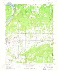
1974 Map of Fort Gibson Dam
USGS Topo · Published 1978About this map
Fort Gibson National Cemetery stands as a significant landmark in this mid-1970s survey, marking the historic landscape near where the Neosho River meets the northern reaches of the Webbers Falls Reservoir. The terrain is defined by a series of prominent elevations, including Norwood Mountain and the Shannon Hills, which are intersected by numerous hollows like Sugar Hollow and Deadman Hollow. This period shows the established presence of the Fort Gibson Lake dam and the surrounding recreation infrastructure, such as the Canyon Road Public Use Area.
Find a feature on this map
53 named features on this map. Tap any name to fly to it.
Don’t see what you’re looking for? This feature index may not catch every label — zoom into the map to look around manually.
Map Details
Editions of this 1974 Fort Gibson Dam Map
This is the sole edition of this map. No revisions or reprints were ever made.
Other maps of this area

1901 · Muscogee
USGS Topo · 1:125,000

1905 · Muscogee
USGS Topo · 1:125,000

1946 · Fort Smith
USGS Topo · 1:250,000

1948 · Hulbert
USGS Topo · 1:62,500

1948 · Keefeton
USGS Topo · 1:62,500

1948 · Webbers Falls
USGS Topo · 1:62,500

1948 · Wagoner
USGS Topo · 1:62,500

1950 · Keefeton
USGS Topo · 1:62,500

1950 · Wagoner
USGS Topo · 1:62,500

1950 · Hulbert
USGS Topo · 1:62,500