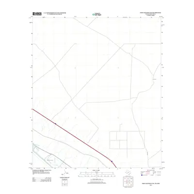
2013 Map of Fort Hancock NW
USGS Topo · Published 2013About this map
The arid landscape of Hudspeth and El Paso counties is defined here by the critical water infrastructure supporting the Rio Grande valley's agricultural heritage. Extensive irrigation works, including the Hudspeth Main Canal, Kelly Lateral, and Kelly Drain, create a complex network of channels that stand in contrast to the surrounding desert terrain. These engineered waterways are central to the region’s identity, allowing for managed cultivation in an otherwise dry environment.
Find a feature on this map
7 named features on this map. Tap any name to fly to it.
Don’t see what you’re looking for? This feature index may not catch every label — zoom into the map to look around manually.
Map Details
Editions of this 2013 Fort Hancock NW Map
This is the sole edition of this map. No revisions or reprints were ever made.
Other maps of this area

1894 · Fort Hancock
USGS Topo · 1:125,000

1896 · El Paso
USGS Topo · 1:125,000

1896 · Rio Grande
USGS Topo · 1:125,000

1903 · Cerro Alto
USGS Topo · 1:125,000

1908 · El Paso
USGS Topo · 1:125,000

1941 · Clint
USGS Topo · 1:62,500

1941 · Tornillo
USGS Topo · 1:62,500

1942 · Borrego
USGS Topo · 1:62,500

1943 · Fort Hancock
USGS Topo · 1:62,500
1945 · Clint
USGS Topo · 1:62,500