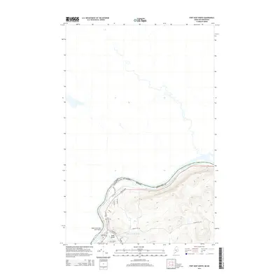
2014 Map of Fort Kent North
USGS Topo · Published 2014About this map
The Saint John River serves as the international boundary between Aroostook County, Maine and New Brunswick, Canada, anchoring the geography of this northern borderland. The town of Fort Kent occupies the confluence where the Fish River meets the larger waterway, serving as a cultural and educational hub for the Upper Saint John River Valley. Evidence of the region’s long-standing community roots is found at the University of Maine at Fort Kent and the nearby Saint Louis Cem and Old Saint Louis Cem, which reflect the French-Acadian heritage of the residents. Rising above the river plain, the steep terrain of Charette Hill overlooks a network of local roads such as Frenchville Rd and Kent Rd, which follow the contours of the drainage basin carved by Regiest Daigle Brook.
Find a feature on this map
22 named features on this map. Tap any name to fly to it.
Don’t see what you’re looking for? This feature index may not catch every label — zoom into the map to look around manually.
Map Details
Editions of this 2014 Fort Kent North Map
This is the sole edition of this map. No revisions or reprints were ever made.
Other maps of this area

1927 · Square Lake
USGS Topo · 1:48,000

1928 · Eagle Lake
USGS Topo · 1:48,000

1931 · Square Lake
USGS Topo · 1:62,500

1931 · Eagle Lake
USGS Topo · 1:62,500

1932 · Frenchville
USGS Topo · 1:48,000

1932 · Fort Kent
USGS Topo · 1:48,000

1935 · Fort Kent
USGS Topo · 1:62,500

1935 · Frenchville
USGS Topo · 1:62,500

1953 · Square Lake
USGS Topo · 1:62,500

1962 · Edmundston
USGS Topo · 1:250,000