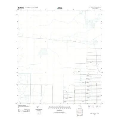
2012 Map of Fort Kissimmee SE
USGS Topo · Published 2012About this map
Sevenmile Slough and Duck Slough carve through the wet prairie landscape of northern Okeechobee County, defining the hydrologic character of this rural Florida interior. The map reveals a transition from open, water-logged terrain to an organized grid of residential or agricultural road development in the southeast. A dense network of numbered thoroughfares, such as 300th St and NW 320th St, marks the progression of land partitioning in the region. The contrast between the natural, winding sloughs and the rigid, artificial layout of the streets illustrates the intersection of Florida's native wetlands with modern rural infrastructure. Researchers can trace the exact footprint of these drainage features alongside the growing network of secondary roads that define the area's local geography.
Find a feature on this map
43 named features on this map. Tap any name to fly to it.
Don’t see what you’re looking for? This feature index may not catch every label — zoom into the map to look around manually.
Map Details
Editions of this 2012 Fort Kissimmee SE Map
This is the sole edition of this map. No revisions or reprints were ever made.
Other maps of this area

1952 · Fort Kissimmee
USGS Topo · 1:24,000

1952 · Fort Kissimmee NW
USGS Topo · 1:24,000

1953 · Taylor Creek NW
USGS Topo · 1:24,000

1953 · Basinger
USGS Topo · 1:24,000

1953 · Fort Kissimmee NE
USGS Topo · 1:24,000

1953 · Fort Drum SW
USGS Topo · 1:24,000

1953 · Fort Drum NW
USGS Topo · 1:24,000

1953 · Basinger NW
USGS Topo · 1:24,000

1953 · Fort Kissimmee SE
USGS Topo · 1:24,000

1956 · Fort Pierce
USGS Topo · 1:250,000