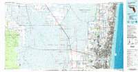
1985 Map of Fort Lauderdale
USGS Topo · Published 1986About this map
The Everglades dominate the western half of this mid-1980s coastal survey, revealing a sharp contrast between the conserved wetlands of the Loxahatchee National Wildlife Refuge and the dense urban corridor of Broward County. To the east, the sprawling growth of Fort Lauderdale and Pompano Beach is bounded by the Hillsboro Canal and the Atlantic coastline, where maritime commerce centers on Port Everglades. The map documents a critical period in South Florida water management, showing the intricate grid of the North New River Canal and the Miami Canal cutting through the Everglades Wildlife Management Area. Cultural and tribal lands are clearly demarcated, including the Seminole Indian Reservation and Miccosukee Indian Reservation. Transport infrastructure is well established by this era, with the Florida East Coast RR and Seaboard Coast Line RR paralleling the coast to serve settlements from Delray Beach down to Hollywood.
Find a feature on this map
58 named features on this map. Tap any name to fly to it.
Don’t see what you’re looking for? This feature index may not catch every label — zoom into the map to look around manually.
Map Details
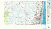
Editions of this 1985 Fort Lauderdale Map
2 editions found
Other maps of this area

1945 · Fort Lauderdale North
USGS Topo · 1:24,000

1945 · Greenacres City
USGS Topo · 1:24,000

1945 · Lake Worth
USGS Topo · 1:24,000

1946 · West Dixie Bend
USGS Topo · 1:24,000

1946 · Boca Raton
USGS Topo · 1:24,000

1947 · North Miami
USGS Topo · 1:24,000

1947 · Delmar Farms
USGS Topo · 1:24,000

1949 · Lake Worth
USGS Topo · 1:24,000

1949 · Opalocka
USGS Topo · 1:24,000

1949 · Fort Lauderdale North
USGS Topo · 1:24,000