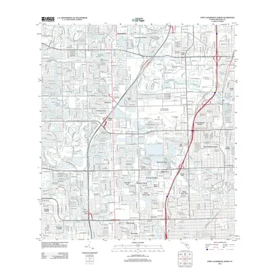
2012 Map of Fort Lauderdale North
USGS Topo · Published 2012About this map
North Andrews Gardens and surrounding neighborhoods define this densely developed portion of Broward County during the early 21st century. The landscape is characterized by a complex network of residential grids and water management features, including the Cypress Cr Canal and Pompano Canal. Significant institutional footprints are visible, such as the Broward Community College - North Campus and Keiser College, alongside major athletic venues like Lockhart Stadium and Fort Lauderdale Stadium.
Find a feature on this map
130 named features on this map. Tap any name to fly to it.
Don’t see what you’re looking for? This feature index may not catch every label — zoom into the map to look around manually.
Map Details
Editions of this 2012 Fort Lauderdale North Map
This is the sole edition of this map. No revisions or reprints were ever made.
Other maps of this area

1945 · Fort Lauderdale North
USGS Topo · 1:24,000

1946 · West Dixie Bend
USGS Topo · 1:24,000

1946 · Boca Raton
USGS Topo · 1:24,000

1949 · Fort Lauderdale North
USGS Topo · 1:24,000

1949 · West Dixie Bend
USGS Topo · 1:24,000

1949 · Port Everglades
USGS Topo · 1:24,000

1949 · Fort Lauderdale South
USGS Topo · 1:24,000

1949 · Pompano Beach
USGS Topo · 1:24,000

1950 · Boca Raton
USGS Topo · 1:24,000

1956 · West Palm Beach
USGS Topo · 1:250,000