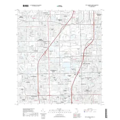
2018 Map of Fort Lauderdale North
USGS Topo · Published 2018About this map
The dense suburban grid of North Lauderdale, Oakland Park, and Lauderdale Lakes dominates this modern topographical study of Broward County. The landscape is defined by its complex water management systems, including the Cypress Creek Canal and the branching segments of the North Fork Middle River. These waterways, alongside the Middle River Canal, weave through residential enclaves like Sabal Palms Estates and North Andrews Gardens, illustrating the engineered drainage that allowed for the region's late-century expansion.
Find a feature on this map
88 named features on this map. Tap any name to fly to it.
Don’t see what you’re looking for? This feature index may not catch every label — zoom into the map to look around manually.
Map Details
Editions of this 2018 Fort Lauderdale North Map
This is the sole edition of this map. No revisions or reprints were ever made.
Other maps of this area

1945 · Fort Lauderdale North
USGS Topo · 1:24,000

1946 · West Dixie Bend
USGS Topo · 1:24,000

1946 · Boca Raton
USGS Topo · 1:24,000

1949 · Fort Lauderdale North
USGS Topo · 1:24,000

1949 · West Dixie Bend
USGS Topo · 1:24,000

1949 · Port Everglades
USGS Topo · 1:24,000

1949 · Fort Lauderdale South
USGS Topo · 1:24,000

1949 · Pompano Beach
USGS Topo · 1:24,000

1950 · Boca Raton
USGS Topo · 1:24,000

1956 · West Palm Beach
USGS Topo · 1:250,000