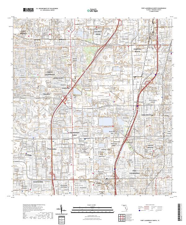
2024 Map of Fort Lauderdale North
USGS Topo · Published 2024About this map
Lauderdale Lakes and Wilton Manors anchor this detailed study of Broward County’s residential and commercial development. The landscape is defined by an intricate network of waterways, including the Cypress Creek Canal and the Middle River Canal, which weave through suburban neighborhoods like Margate Estates and Sabal Palms Estates. This survey illustrates the density of the Florida interior, where planned communities and educational hubs like Broward College North Campus and the University of Fort Lauderdale have replaced former agricultural or undeveloped lands. Large-scale memorial sites such as Our Lady Queen of Heaven Cem and Star of David Memorial Gardens serve as significant local landmarks. The grid-like progression of major thoroughfares, including W Atlantic Blvd and W Sunrise Blvd, highlights the connectivity between inland settlements and the Atlantic coast.
Find a feature on this map
79 named features on this map. Tap any name to fly to it.
Don’t see what you’re looking for? This feature index may not catch every label — zoom into the map to look around manually.
Map Details
Editions of this 2024 Fort Lauderdale North Map
This is the sole edition of this map. No revisions or reprints were ever made.
Other maps of this area

1945 · Fort Lauderdale North
USGS Topo · 1:24,000

1946 · West Dixie Bend
USGS Topo · 1:24,000

1946 · Boca Raton
USGS Topo · 1:24,000

1949 · Fort Lauderdale North
USGS Topo · 1:24,000

1949 · West Dixie Bend
USGS Topo · 1:24,000

1949 · Port Everglades
USGS Topo · 1:24,000

1949 · Fort Lauderdale South
USGS Topo · 1:24,000

1949 · Pompano Beach
USGS Topo · 1:24,000

1950 · Boca Raton
USGS Topo · 1:24,000

1956 · West Palm Beach
USGS Topo · 1:250,000