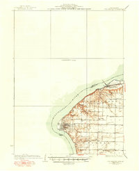
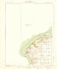
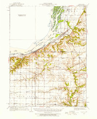
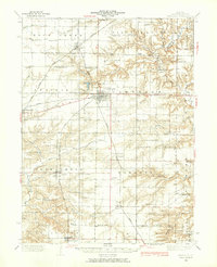
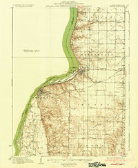
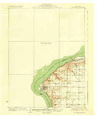
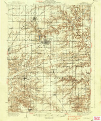
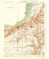
1936 Map of Fort Madison
USGS Topo · Published 1950About this map
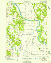
Nauvoo and its grid-patterned streets dominate the eastern bank of the Mississippi River in this detailed survey based on fieldwork from the late 1920s and early 1930s. The landscape reflects a dense network of rural education, with numerous local institutions like Frenchtown Sch, Columbia Sch, and Mound Sch serving the townships of Appanoose and Sonora. Along the river's bend, the infrastructure of the A T & S F railroad links the communities of Niota, Old Niota, and East Ft Madison Niota PO.
Find a feature on this map
26 named features on this map. Tap any name to fly to it.
Don’t see what you’re looking for? This feature index may not catch every label — zoom into the map to look around manually.
Map Details
Editions of this 1936 Fort Madison Map
3 editions found
Other maps of this area

1903 · Kahoka
USGS Topo · 1:125,000
1932 · Lomax
USGS Topo · 1:62,500
1933 · Carthage
USGS Topo · 1:62,500

1934 · Burlington
USGS Topo · 1:48,000
1936 · Keokuk
USGS Topo · 1:62,500
1936 · Fort Madison
USGS Topo · 1:62,500
1937 · Carthage
USGS Topo · 1:62,500
1937 · Lomax
USGS Topo · 1:62,500

1940 · Burlington
USGS Topo · 1:62,500
1949 · Wayland
USGS Topo · 1:24,000