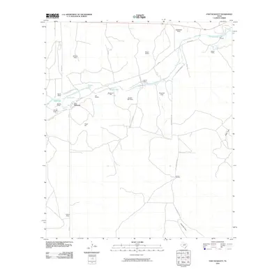
2010 Map of Fort McKavett
USGS Topo · Published 2010About this map
Fort McKavett serves as the focal point of this West Texas landscape, where the historic military site overlooks the headwaters of the San Saba River. The area is defined by its vital water sources, including Government Spring, Opp Spring, and several river pools such as Baptism Hole and Calistro Hole. These springs were essential for the frontier outpost and the ranching operations that followed in Menard County.
Find a feature on this map
34 named features on this map. Tap any name to fly to it.
Don’t see what you’re looking for? This feature index may not catch every label — zoom into the map to look around manually.
Map Details
Editions of this 2010 Fort McKavett Map
This is the sole edition of this map. No revisions or reprints were ever made.
Other maps of this area

1893 · Fort McKavett
USGS Topo · 1:125,000

1954 · Llano
USGS Topo · 1:250,000

1954 · Sonora
USGS Topo · 1:250,000

1955 · Llano
USGS Topo · 1:250,000

1956 · Llano
USGS Topo · 1:250,000

1958 · Sonora
USGS Topo · 1:250,000
1963 · Coal Kiln Draw
USGS Topo · 1:24,000

1963 · McKegan Draw NE
USGS Topo · 1:24,000

1970 · Clear Creek Lake
USGS Topo · 1:24,000

1970 · San Augustine Draw
USGS Topo · 1:24,000