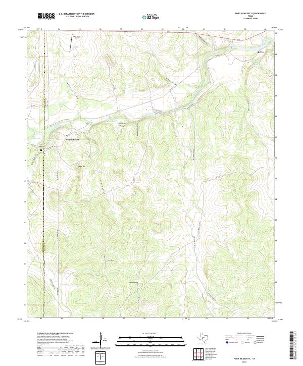
2022 Map of Fort McKavett
USGS Topo · Published 2022About this map
Fort McKavett sits at the heart of this Central Texas landscape, marking a site deeply rooted in the frontier history of the Edwards Plateau. The settlement's proximity to the San Saba River and reliable water sources like Government Springs and Baptism Hole illustrates the vital role of the river corridor in the region's development. Local genealogy is well-represented by the Fort McKavett Cem and the Opp - Bihl Cem near Opp Spring, while landmarks such as Target Hill and Robertson Flat provide geographical context for the terrain surrounding the old military outpost. The network of ranch roads, including Ranch Rd 864 and Preston Rd, connects scattered features like the Herd Ranch Airport and various named draws such as Milligan Draw and Rattlesnake Draw, which define the drainage patterns of this rural limestone landscape.
Find a feature on this map
40 named features on this map. Tap any name to fly to it.
Don’t see what you’re looking for? This feature index may not catch every label — zoom into the map to look around manually.
Map Details
Editions of this 2022 Fort McKavett Map
This is the sole edition of this map. No revisions or reprints were ever made.
Other maps of this area

1893 · Fort McKavett
USGS Topo · 1:125,000

1954 · Llano
USGS Topo · 1:250,000

1954 · Sonora
USGS Topo · 1:250,000

1955 · Llano
USGS Topo · 1:250,000

1956 · Llano
USGS Topo · 1:250,000

1958 · Sonora
USGS Topo · 1:250,000
1963 · Coal Kiln Draw
USGS Topo · 1:24,000

1963 · McKegan Draw NE
USGS Topo · 1:24,000

1970 · Clear Creek Lake
USGS Topo · 1:24,000

1970 · San Augustine Draw
USGS Topo · 1:24,000