
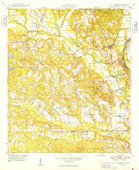
1949 Map of Fort Mitchell
USGS Topo · Published 1949About this map
The Chattahoochee River forms the eastern boundary of this 1940s landscape, where the Fort Benning Military Reservation occupies a significant portion of the riverfront terrain. The area is defined by its strategic position along the Central of Georgia rail line, which connects the small settlements of Lato and Fort Mitchell. The topography is characterized by a dense network of watercourses, including Uchee Creek, Cowpen Creek, and Igahee Creek, which carve through the Russell County hills before reaching the river near Bradley Landing.
Find a feature on this map
20 named features on this map. Tap any name to fly to it.
Don’t see what you’re looking for? This feature index may not catch every label — zoom into the map to look around manually.
Map Details
Editions of this 1949 Fort Mitchell Map
2 editions found
Other maps of this area

1908 · Columbus
USGS Topo · 1:62,500

1914 · Seale
USGS Topo · 1:62,500

1929 · Columbus
USGS Topo · 1:48,000

1947 · Columbus
USGS Topo · 1:62,500

1949 · Julia
USGS Topo · 1:24,000

1949 · Columbus
USGS Topo · 1:24,000

1950 · Fort Benning
USGS Topo · 1:24,000

1950 · Crawford
USGS Topo · 1:24,000

1950 · Seale
USGS Topo · 1:24,000

1950 · Phenix City
USGS Topo · 1:24,000