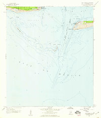
1958 Map of Fort Morgan
USGS Topo · Published 1959About this map
Fort Morgan and Fort Gaines stand as strategic sentinels on either side of the entrance to Mobile Bay, anchoring this late 1950s coastal survey. The map details the shifting sands and navigational hazards at the mouth of the bay, including the Sand Island Channel and the expansive Pelican Bay. On Dauphin Island, the burgeoning coastal communities of Bienville Beach and Dauphin Beach are visible alongside local features like Alligator Lake.
Find a feature on this map
30 named features on this map. Tap any name to fly to it.
Don’t see what you’re looking for? This feature index may not catch every label — zoom into the map to look around manually.
Map Details
Editions of this 1958 Fort Morgan Map
4 editions found
Other maps of this area

1921 · Point Clear
USGS Topo · 1:62,500

1921 · Dauphin Island
USGS Topo · 1:62,500

1921 · Delchamps
USGS Topo · 1:62,500

1941 · Cedar Point
USGS Topo · 1:62,500

1941 · Weeks Bay
USGS Topo · 1:62,500

1942 · Fort Morgan
USGS Topo · 1:62,500

1943 · Cedar Point
USGS Topo · 1:62,500

1943 · Weeks Bay
USGS Topo · 1:62,500

1953 · Mobile
USGS Topo · 1:250,000

1957 · Mobile
USGS Topo · 1:250,000