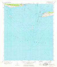
1958 Map of Fort Morgan
USGS Topo · Published 1969About this map
Dauphin Island serves as the focal point for this coastal survey, where the eastern edge of the barrier island meets the Gulf of Mexico. This map illustrates the shoreline and local geography before later 20th-century developments, showing the relative isolation of Bienville Beach at the edge of the Alabama coast. The survey highlights the intersection of land and sea, reflecting the maritime character of the region during the late 1950s. While human settlements are concentrated on the island, the surrounding waters remain the dominant feature of this coastal landscape.
Find a feature on this map
2 named features on this map. Tap any name to fly to it.
Don’t see what you’re looking for? This feature index may not catch every label — zoom into the map to look around manually.
Map Details
Editions of this 1958 Fort Morgan Map
4 editions found
Other maps of this area

1921 · Point Clear
USGS Topo · 1:62,500

1921 · Dauphin Island
USGS Topo · 1:62,500

1921 · Delchamps
USGS Topo · 1:62,500

1941 · Cedar Point
USGS Topo · 1:62,500

1941 · Weeks Bay
USGS Topo · 1:62,500

1942 · Fort Morgan
USGS Topo · 1:62,500

1943 · Cedar Point
USGS Topo · 1:62,500

1943 · Weeks Bay
USGS Topo · 1:62,500

1953 · Mobile
USGS Topo · 1:250,000

1957 · Mobile
USGS Topo · 1:250,000