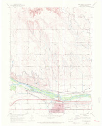
1951 Map of Fort Morgan
USGS Topo · Published 1972About this map
Fort Morgan serves as the industrial and civic anchor of this landscape, situated along the south bank of the South Platte River. The town's 1950s infrastructure is clearly defined, featuring a Sugar Refinery, a Hospital, and several educational facilities including Lincoln Sch and Baker Sch. Transportation and irrigation networks dominate the surrounding valley, with the Union Pacific railroad and the Upper Platte and Beaver Canal following the river's path.
Find a feature on this map
58 named features on this map. Tap any name to fly to it.
Don’t see what you’re looking for? This feature index may not catch every label — zoom into the map to look around manually.
Map Details
Editions of this 1951 Fort Morgan Map
4 editions found
Other maps of this area

1951 · Weldona
USGS Topo · 1:24,000

1951 · Dead Horse Springs
USGS Topo · 1:24,000

1951 · Brush West
USGS Topo · 1:24,000

1951 · Peace Valley School
USGS Topo · 1:24,000

1951 · Judson Hills
USGS Topo · 1:24,000

1951 · Fort Morgan
USGS Topo · 1:24,000

1954 · Sterling
USGS Topo · 1:250,000

1958 · Sterling
USGS Topo · 1:250,000

1963 · Lamb
USGS Topo · 1:24,000

1963 · Round Top
USGS Topo · 1:24,000