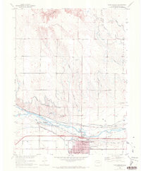
1951 Map of Fort Morgan
USGS Topo · Published 1972About this map
Fort Morgan serves as the focal point of this mid-century landscape, characterized by the vital relationship between the South Platte River and the complex irrigation network that sustains the high plains. The map reveals an intensive agricultural and transport hub where The Great Western Railway and the Union Pacific converge near a large Sugar Refinery. This industrial presence, coupled with the local infrastructure of the High Sch, Lincoln Sch, and Baker Sch, illustrates the town's role as a regional center for Morgan County.
Find a feature on this map
45 named features on this map. Tap any name to fly to it.
Don’t see what you’re looking for? This feature index may not catch every label — zoom into the map to look around manually.
Map Details
Editions of this 1951 Fort Morgan Map
4 editions found
Other maps of this area

1951 · Weldona
USGS Topo · 1:24,000

1951 · Dead Horse Springs
USGS Topo · 1:24,000

1951 · Brush West
USGS Topo · 1:24,000

1951 · Peace Valley School
USGS Topo · 1:24,000

1951 · Judson Hills
USGS Topo · 1:24,000

1951 · Fort Morgan
USGS Topo · 1:24,000

1954 · Sterling
USGS Topo · 1:250,000

1958 · Sterling
USGS Topo · 1:250,000

1963 · Lamb
USGS Topo · 1:24,000

1963 · Round Top
USGS Topo · 1:24,000