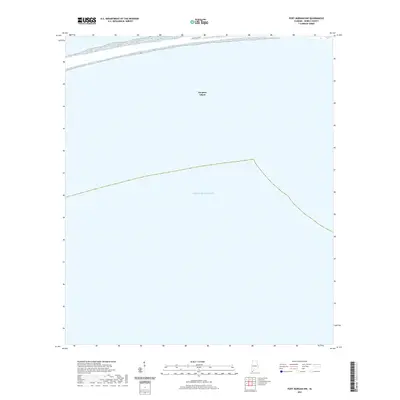
2021 Map of Fort Morgan NW
USGS Topo · Published 2021About this map
Dauphin Island presents a focused perspective on the western reaches of this barrier island along the Alabama coast. This 2021 survey illustrates the precarious and narrow geography of the island as it transitions into the open Gulf of Mexico. The primary infrastructure shown is Bienville Blvd, the central artery that dictates the settlement pattern and accessibility of the shoreline. The map captures the coastal interface at a specific moment in time, documenting the relationship between the built environment and the shifting sands of the Gulf Coast.
Find a feature on this map
3 named features on this map. Tap any name to fly to it.
Don’t see what you’re looking for? This feature index may not catch every label — zoom into the map to look around manually.
Map Details
Editions of this 2021 Fort Morgan NW Map
This is the sole edition of this map. No revisions or reprints were ever made.
Other maps of this area

1921 · Grand Bay
USGS Topo · 1:62,500

1921 · Petit Bois Island
USGS Topo · 1:62,500

1921 · Dauphin Island
USGS Topo · 1:62,500

1921 · Delchamps
USGS Topo · 1:62,500

1941 · Cedar Point
USGS Topo · 1:62,500

1942 · Petit Bois Island
USGS Topo · 1:62,500

1942 · Fort Morgan
USGS Topo · 1:62,500

1943 · Cedar Point
USGS Topo · 1:62,500

1943 · Grand Bay
USGS Topo · 1:62,500

1953 · Mobile
USGS Topo · 1:250,000