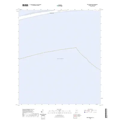
2024 Map of Fort Morgan NW
USGS Topo · Published 2024About this map
Dauphin Island stretches along the top margin of this quadrangle, represented here at a moment when the barrier island's primary thoroughfare, Bienville Blvd, serves as the spine for coastal settlement. The map focuses predominantly on the open waters of the Gulf of Mexico, providing a clear record of the shoreline's position in 2024. This perspective is particularly valuable for documenting the coastal geography and road infrastructure of Mobile County before further shifting sands or seasonal weather patterns alter the southern edge of the island. The contrast between the thin strip of inhabited land and the expansive marine environment highlights the exposed nature of this Alabama barrier island.
Find a feature on this map
4 named features on this map. Tap any name to fly to it.
Don’t see what you’re looking for? This feature index may not catch every label — zoom into the map to look around manually.
Map Details
Editions of this 2024 Fort Morgan NW Map
This is the sole edition of this map. No revisions or reprints were ever made.
Other maps of this area

1921 · Grand Bay
USGS Topo · 1:62,500

1921 · Petit Bois Island
USGS Topo · 1:62,500

1921 · Dauphin Island
USGS Topo · 1:62,500

1921 · Delchamps
USGS Topo · 1:62,500

1941 · Cedar Point
USGS Topo · 1:62,500

1942 · Petit Bois Island
USGS Topo · 1:62,500

1942 · Fort Morgan
USGS Topo · 1:62,500

1943 · Cedar Point
USGS Topo · 1:62,500

1943 · Grand Bay
USGS Topo · 1:62,500

1953 · Mobile
USGS Topo · 1:250,000