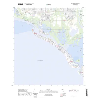
2024 Map of Fort Myers Beach
USGS Topo · Published 2024About this map
Fort Myers Beach and the barrier islands of Lee County are documented here in high detail, showcasing a coastal landscape defined by intricate waterways and modern development. Stretching from the historic Punta Rassa area and Connie Mack Island in the north down to Lovers Key and Black Island, the map reveals the complex geography of San Carlos Bay and the narrow, developed corridor of Estero Island.
Find a feature on this map
59 named features on this map. Tap any name to fly to it.
Don’t see what you’re looking for? This feature index may not catch every label — zoom into the map to look around manually.
Map Details
Editions of this 2024 Fort Myers Beach Map
This is the sole edition of this map. No revisions or reprints were ever made.
Other maps of this area

1956 · West Palm Beach
USGS Topo · 1:250,000

1956 · Tampa
USGS Topo · 1:250,000

1956 · Charlotte Harbor
USGS Topo · 1:250,000

1957 · West Palm Beach
USGS Topo · 1:250,000

1958 · West Palm Beach
USGS Topo · 1:250,000

1958 · Bonita Springs
USGS Topo · 1:24,000

1958 · Estero
USGS Topo · 1:24,000

1958 · Fort Myers SW
USGS Topo · 1:24,000

1958 · Sanibel
USGS Topo · 1:24,000

1958 · Pine Island Center
USGS Topo · 1:24,000