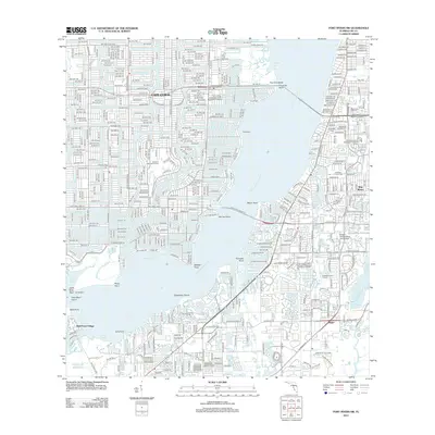
2012 Map of Fort Myers SW
USGS Topo · Published 2012About this map
The Caloosahatchee River serves as the central artery for this coastal Lee County landscape, separating the planned residential canals of Cape Coral from the mainland. The intricate network of waterways is particularly evident around Bimini Basin and the residential fingers extending into Redfish Cove. On the eastern bank, the transition from urban density to recreational spaces is marked by the Edison State College - Lee Campus and sprawling greenspaces like the Dubsdread Golf Course.
Find a feature on this map
48 named features on this map. Tap any name to fly to it.
Don’t see what you’re looking for? This feature index may not catch every label — zoom into the map to look around manually.
Map Details
Editions of this 2012 Fort Myers SW Map
This is the sole edition of this map. No revisions or reprints were ever made.
Other maps of this area

1956 · West Palm Beach
USGS Topo · 1:250,000

1956 · Tampa
USGS Topo · 1:250,000

1956 · Charlotte Harbor
USGS Topo · 1:250,000

1957 · West Palm Beach
USGS Topo · 1:250,000

1958 · West Palm Beach
USGS Topo · 1:250,000

1958 · Matlacha
USGS Topo · 1:24,000

1958 · Fort Myers NW
USGS Topo · 1:24,000

1958 · Estero
USGS Topo · 1:24,000

1958 · Fort Myers SW
USGS Topo · 1:24,000

1958 · Sanibel
USGS Topo · 1:24,000