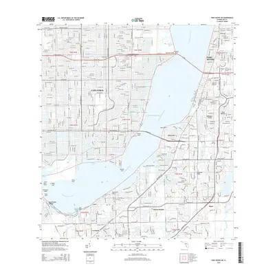
2015 Map of Fort Myers SW
USGS Topo · Published 2015About this map
The Caloosahatchee River serves as the central artery for this region, separating the expansive planned canal network of Cape Coral from the established neighborhoods of Fort Myers. This 2015 survey reveals the intricate suburban development of Southwest Florida, where the Okeechobee Waterway meets local landmarks like Bimini Basin and Redfish Cove. South of the main channel, the landscape transitions into distinct residential communities such as Whiskey Creek, McGregor, and Iona, with education hubs like Edison State Coll and Southwest Florida Coll anchoring the local infrastructure. The map illustrates how human engineering has shaped the shoreline, from the residential canals of the north to the managed waterways of Cypress Lake and Hendry Creek in the south, providing a detailed view of the area's modern topography and water management systems.
Find a feature on this map
51 named features on this map. Tap any name to fly to it.
Don’t see what you’re looking for? This feature index may not catch every label — zoom into the map to look around manually.
Map Details
Editions of this 2015 Fort Myers SW Map
This is the sole edition of this map. No revisions or reprints were ever made.
Other maps of this area

1956 · West Palm Beach
USGS Topo · 1:250,000

1956 · Tampa
USGS Topo · 1:250,000

1956 · Charlotte Harbor
USGS Topo · 1:250,000

1957 · West Palm Beach
USGS Topo · 1:250,000

1958 · West Palm Beach
USGS Topo · 1:250,000

1958 · Matlacha
USGS Topo · 1:24,000

1958 · Fort Myers NW
USGS Topo · 1:24,000

1958 · Estero
USGS Topo · 1:24,000

1958 · Fort Myers SW
USGS Topo · 1:24,000

1958 · Sanibel
USGS Topo · 1:24,000