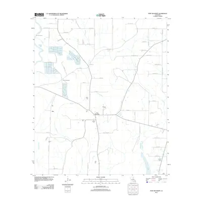
2012 Map of Fort Necessity
USGS Topo · Published 2012About this map
Fort Necessity and the neighboring settlement of Buie anchor this rural landscape in Franklin Parish, defined by a network of bayous and slow-moving creeks. The area is characterized by a high concentration of small burial grounds, including Boeuf Prairie Cem, Wiggers Cem, and Saint Paul Cem, which reflect the localized family and community histories of this agricultural region. The drainage patterns are complex, with Goose Cr winding through the western portion near Mullen Lake, while S Pricket Bayou and W Turkey Cr traverse the eastern plains.
Find a feature on this map
77 named features on this map. Tap any name to fly to it.
Don’t see what you’re looking for? This feature index may not catch every label — zoom into the map to look around manually.
Map Details
Editions of this 2012 Fort Necessity Map
This is the sole edition of this map. No revisions or reprints were ever made.
Other maps of this area

1935 · Winnsboro
USGS Topo · 1:62,500

1939 · Fort Necessity
USGS Topo · 1:62,500

1941 · Sicily Island
USGS Topo · 1:62,500

1941 · Harrisonburg
USGS Topo · 1:62,500

1953 · Natchez
USGS Topo · 1:250,000

1955 · Jackson
USGS Topo · 1:250,000

1956 · Natchez
USGS Topo · 1:250,000

1957 · Sicily Island
USGS Topo · 1:62,500

1958 · Winnsboro
USGS Topo · 1:62,500

1958 · Fort Necessity
USGS Topo · 1:62,500