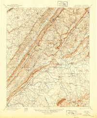
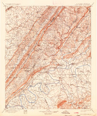
1900 Map of Fort Payne
USGS Topo · Published 1944About this map
Fort Payne serves as the focal point of this northeast Alabama landscape, situated in the valley between the towering Lookout Mountain and Shinbone Ridge. At the turn of the century, the region's economy was anchored by its complex waterway network and developing rail lines. The Coosa River is particularly noteworthy for its dense concentration of river crossings, including Ewing Ferry, Tripp Ferry, and Adams Ferry, reflecting a time before modern bridge infrastructure. Local industry is evidenced by numerous rural mills such as Sauty Mills and Longshore Mill, which were essential to these agrarian communities.
Find a feature on this map
168 named features on this map. Tap any name to fly to it.
Don’t see what you’re looking for? This feature index may not catch every label — zoom into the map to look around manually.
Map Details
Editions of this 1900 Fort Payne Map
6 editions found

Other maps of this area

1885 · Gadsden
USGS Topo · 1:125,000

1886 · Ringgold
USGS Topo · 1:125,000

1886 · Rome
USGS Topo · 1:125,000

1886 · Stevenson
USGS Topo · 1:125,000

1888 · Gadsden
USGS Topo · 1:125,000

1888 · Scottsboro
USGS Topo · 1:125,000

1889 · Tallapoosa
USGS Topo · 1:125,000

1889 · Springville
USGS Topo · 1:125,000

1892 · Ringgold
USGS Topo · 1:125,000

1892 · Springville
USGS Topo · 1:125,000