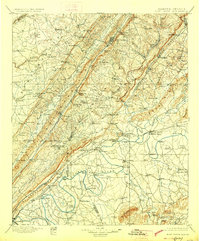
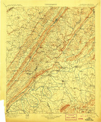
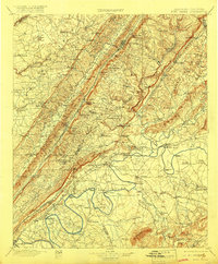
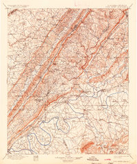
1900 Map of Fort Payne
USGS Topo · Published 1927About this map
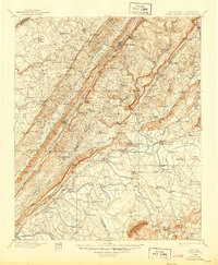
Fort Payne and the surrounding Lookout Mountain landscape appear in this late nineteenth-century survey, revealing a region defined by its complex topography and river-based transport. The map documents the industrial and natural features of the era, from the subterranean depths of Manitou Cave to the prominent heights of Round Mountain. Transportation networks are notably dense, showing the Southern R. R. and Chattanooga R. R. carving through gaps in the ridges, while numerous river crossings like Wood Ferry, Adams Ferry, and Lawrence Ferry provided vital links across the Coosa River and its tributaries.
Find a feature on this map
166 named features on this map. Tap any name to fly to it.
Don’t see what you’re looking for? This feature index may not catch every label — zoom into the map to look around manually.
Map Details
Editions of this 1900 Fort Payne Map
6 editions found

Other maps of this area

1885 · Gadsden
USGS Topo · 1:125,000

1886 · Ringgold
USGS Topo · 1:125,000

1886 · Rome
USGS Topo · 1:125,000

1886 · Stevenson
USGS Topo · 1:125,000

1888 · Gadsden
USGS Topo · 1:125,000

1888 · Scottsboro
USGS Topo · 1:125,000

1889 · Tallapoosa
USGS Topo · 1:125,000

1889 · Springville
USGS Topo · 1:125,000

1892 · Ringgold
USGS Topo · 1:125,000

1892 · Springville
USGS Topo · 1:125,000