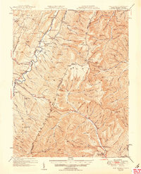
1951 Map of Fort Seybert
USGS Topo · Published 1951About this map
The South Fork Potomac River carves through the central valley of this 1951 survey, a region defined by its high ridges and isolated rural communities. The map captures the settled landscape of eastern Pendleton County and its border with Virginia shortly after the war, showing a high concentration of institutional landmarks that served these valley neighborhoods. Local history and genealogy are anchored by specific names like the New Bethlehem Ch, Bethlehem Ch, and Fame (PO), alongside numerous small schoolhouses such as Dunkle Sch and the Pleasant Grove Ch Dale Hill Sch. The topography is particularly dense, with peaks like Flagpole Knob and Mitchell Knob looming over the river flats. For those looking for early recreation sites, the Riven Rock Picnic Grounds and Hall Spr indicate the area's transition into the George Washington National Forest.
Find a feature on this map
155 named features on this map. Tap any name to fly to it.
Don’t see what you’re looking for? This feature index may not catch every label — zoom into the map to look around manually.
Map Details
Editions of this 1951 Fort Seybert Map
2 editions found
Other maps of this area

1892 · Franklin
USGS Topo · 1:125,000

1892 · Woodstock
USGS Topo · 1:125,000

1892 · Harrisonburg
USGS Topo · 1:125,000

1894 · Staunton
USGS Topo · 1:125,000

1896 · Franklin
USGS Topo · 1:125,000

1920 · Petersburg
USGS Topo · 1:48,000

1920 · Onego
USGS Topo · 1:62,500

1921 · Orkney Springs
USGS Topo · 1:48,000

1921 · Petersburg
USGS Topo · 1:48,000

1921 · Onego
USGS Topo · 1:48,000