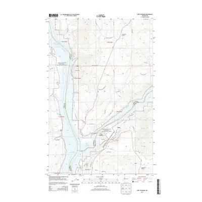
2013 Map of Fort Spokane
USGS Topo · Published 2013About this map
Fort Spokane and its nearby bridge stand at the strategic confluence of the Columbia River and the Spokane River Arm. This 2013 survey illustrates the dramatic geography created by the impoundment of Franklin D Roosevelt Lake, which separates the Colville Indian Reservation to the west from the Spokane Indian Reservation to the east. The terrain is marked by steep draws and canyons, including Sallie Draw and Denison Canyon, while the high plateaus are home to scattered settlements like Miles, Crystal City, and Egypt.
Find a feature on this map
63 named features on this map. Tap any name to fly to it.
Don’t see what you’re looking for? This feature index may not catch every label — zoom into the map to look around manually.
Map Details
Editions of this 2013 Fort Spokane Map
This is the sole edition of this map. No revisions or reprints were ever made.
Other maps of this area

1948 · Hunters
USGS Topo · 1:62,500

1948 · Wilmont Creek
USGS Topo · 1:62,500

1948 · Lincoln
USGS Topo · 1:62,500

1948 · Turtle Lake
USGS Topo · 1:62,500

1950 · Lincoln
USGS Topo · 1:62,500

1950 · Turtle Lake
USGS Topo · 1:62,500

1950 · Wilmont Creek
USGS Topo · 1:62,500

1950 · Hunters
USGS Topo · 1:62,500

1953 · Ritzville
USGS Topo · 1:250,000

1954 · Okanogan
USGS Topo · 1:250,000