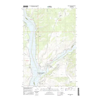
2017 Map of Fort Spokane
USGS Topo · Published 2017About this map
Fort Spokane sits at the strategic confluence where the Spokane River Arm meets the Columbia River, now part of the Lake Roosevelt National Recreation Area. The landscape is dominated by the reservoir formed by Grand Coulee Dam, which submerged former riverbanks and created features like Abraham Cove. Notable geological landmarks rise above the water, including the prominent Castle Rock and Mitre Rock.
Find a feature on this map
57 named features on this map. Tap any name to fly to it.
Don’t see what you’re looking for? This feature index may not catch every label — zoom into the map to look around manually.
Map Details
Editions of this 2017 Fort Spokane Map
This is the sole edition of this map. No revisions or reprints were ever made.
Other maps of this area

1948 · Hunters
USGS Topo · 1:62,500

1948 · Wilmont Creek
USGS Topo · 1:62,500

1948 · Lincoln
USGS Topo · 1:62,500

1948 · Turtle Lake
USGS Topo · 1:62,500

1950 · Lincoln
USGS Topo · 1:62,500

1950 · Turtle Lake
USGS Topo · 1:62,500

1950 · Wilmont Creek
USGS Topo · 1:62,500

1950 · Hunters
USGS Topo · 1:62,500

1953 · Ritzville
USGS Topo · 1:250,000

1954 · Okanogan
USGS Topo · 1:250,000