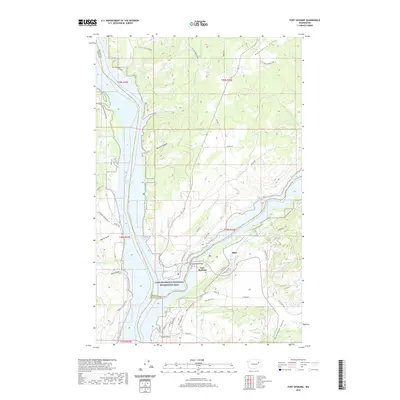
2020 Map of Fort Spokane
USGS Topo · Published 2020About this map
Fort Spokane and the surrounding wilderness of the Lake Roosevelt National Recreation Area dominate this landscape where the Columbia and Spokane rivers converge. The modern impoundment of Franklin D Roosevelt Lake has transformed the river valleys, though the high ground remains defined by the rugged geometry of Miller Mountain and the deep incisions of Denison Canyon and Bockemuehl Canyon. Local settlements like Miles and the descriptive Swede Flats provide a sense of the small-scale ranching and residential history of this part of Lincoln County. The map details a complex network of forest and county roads such as Kieffer Rd and Miles Creston Rd N that weave through Enterprise Valley, connecting isolated homesteads to the shoreline at Abraham Cove and the Spokane River Arm.
Find a feature on this map
55 named features on this map. Tap any name to fly to it.
Don’t see what you’re looking for? This feature index may not catch every label — zoom into the map to look around manually.
Map Details
Editions of this 2020 Fort Spokane Map
This is the sole edition of this map. No revisions or reprints were ever made.
Other maps of this area

1948 · Hunters
USGS Topo · 1:62,500

1948 · Wilmont Creek
USGS Topo · 1:62,500

1948 · Lincoln
USGS Topo · 1:62,500

1948 · Turtle Lake
USGS Topo · 1:62,500

1950 · Lincoln
USGS Topo · 1:62,500

1950 · Turtle Lake
USGS Topo · 1:62,500

1950 · Wilmont Creek
USGS Topo · 1:62,500

1950 · Hunters
USGS Topo · 1:62,500

1953 · Ritzville
USGS Topo · 1:250,000

1954 · Okanogan
USGS Topo · 1:250,000