
1963 Map of Fort Stanton
USGS Topo · Published 1966About this map
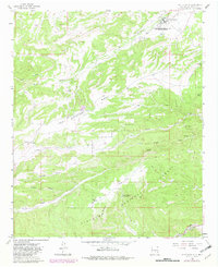
Fort Stanton serves as the focal point of this 1963 survey, where the historic military post's transition into a Hospital and Training School is clearly documented. The landscape is defined by the broad plateau of Fort Stanton Mesa and the winding course of the Rio Bonito, which cuts through the northern portion of the quadrangle. To the south, the terrain rises into the Lincoln National Forest, marked by landmarks like Hightower Mountain and Goat Mountain. Local life and transit are reflected in the presence of the San Ysidro Ch and Cem near the Rio Ruidoso, while a remote Landing Area and various Jeep Trails speak to the region's isolated geography. The map also captures several smaller agricultural and social outposts, including the Four K Ranch and Camp Sierra Blanca.
Find a feature on this map
28 named features on this map. Tap any name to fly to it.
Don’t see what you’re looking for? This feature index may not catch every label — zoom into the map to look around manually.
Map Details
Editions of this 1963 Fort Stanton Map
2 editions found
Other maps of this area

1934 · Capitan
USGS Topo · 1:48,000

1935 · Capitan Mountains
USGS Topo · 1:48,000

1937 · Capitan
USGS Topo · 1:62,500

1940 · Capitan Mountains
USGS Topo · 1:62,500

1955 · Roswell
USGS Topo · 1:250,000

1958 · Roswell
USGS Topo · 1:250,000

1961 · Lincoln
USGS Topo · 1:62,500

1962 · Roswell
USGS Topo · 1:250,000

1963 · Ruidoso Downs
USGS Topo · 1:24,000

1963 · Ruidoso
USGS Topo · 1:24,000