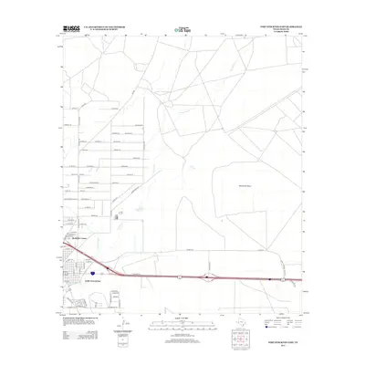
2012 Map of Fort Stockton East
USGS Topo · Published 2012About this map
The city of Fort Stockton serves as the focal point of this West Texas landscape, where the transition from municipal grid to open range is marked by a complex network of named roads and water management features. Arid land features like Sevenmile Mesa dominate the eastern topography, while the intermittent path of Comanche Creek and the localized Cold Springs highlight the critical role of water in this desert environment. Settlement patterns are visible in the residential layout of Bodieville Colonia and the development along Industrial Blvd, reflecting the area's growth in the early 21st century. Infrastructure for agricultural and municipal use is evidenced by the Highline Ditch, which cuts through the southwestern corner of the quadrangle, illustrating the engineering required to sustain this community in the Trans-Pecos region.
Find a feature on this map
75 named features on this map. Tap any name to fly to it.
Don’t see what you’re looking for? This feature index may not catch every label — zoom into the map to look around manually.
Map Details
Editions of this 2012 Fort Stockton East Map
This is the sole edition of this map. No revisions or reprints were ever made.
Other maps of this area

1921 · Fort Stockton
USGS Topo · 1:62,500

1923 · Fort Stockton
USGS Topo · 1:62,500

1928 · Comanche Spring
USGS Topo · 1:125,000

1954 · Pecos
USGS Topo · 1:250,000

1954 · Fort Stockton
USGS Topo · 1:250,000

1957 · Pecos
USGS Topo · 1:250,000

1958 · Fort Stockton
USGS Topo · 1:250,000

1970 · Fort Stockton West
USGS Topo · 1:24,000

1970 · Twelvemile Mesa
USGS Topo · 1:24,000

1970 · East Mesa
USGS Topo · 1:24,000