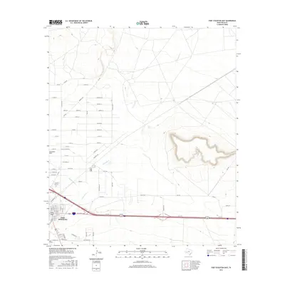
2016 Map of Fort Stockton East
USGS Topo · Published 2016About this map
Fort Stockton sits at the western edge of this Pecos County landscape, where the Chihuahuan Desert meets the expanding industrial and residential footprints of West Texas. The terrain is dominated by the prominent rise of Sevenmile Mesa to the east, a distinctive landform that overlooks the seasonal drainage of Comanche Cr. Historical water sources like Cold Springs and the managed flow of the Highline Ditch underscore the critical importance of water management in this arid environment. The map captures a transition between the established street grid of the town and a network of outlying roads such as Imperial Hwy and Fm 1053. Economic activity is evidenced by the development along Industrial Rd, reflecting the area's role as a regional hub for transportation and resource management in the early twenty-first century.
Find a feature on this map
75 named features on this map. Tap any name to fly to it.
Don’t see what you’re looking for? This feature index may not catch every label — zoom into the map to look around manually.
Map Details
Editions of this 2016 Fort Stockton East Map
This is the sole edition of this map. No revisions or reprints were ever made.
Other maps of this area

1921 · Fort Stockton
USGS Topo · 1:62,500

1923 · Fort Stockton
USGS Topo · 1:62,500

1928 · Comanche Spring
USGS Topo · 1:125,000

1954 · Pecos
USGS Topo · 1:250,000

1954 · Fort Stockton
USGS Topo · 1:250,000

1957 · Pecos
USGS Topo · 1:250,000

1958 · Fort Stockton
USGS Topo · 1:250,000

1970 · Fort Stockton West
USGS Topo · 1:24,000

1970 · Twelvemile Mesa
USGS Topo · 1:24,000

1970 · East Mesa
USGS Topo · 1:24,000