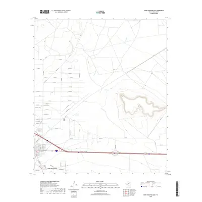
2019 Map of Fort Stockton East
USGS Topo · Published 2019About this map
Fort Stockton anchors this landscape, positioned where the desert floor meets the rising topography of the Trans-Pecos. The map details the transition from the city’s eastern residential and industrial sectors, including names like Shaddox Ln and Rigsby Ln, to the open terrain defined by Sevenmile Mesa. Water management remains a critical theme for this arid region, visible through the presence of Comanche Cr, the Highline Ditch, and Cold Springs. Genealogists and local historians will find significant value in the southern edge of the survey, which clearly marks the East Hill Cem and the access provided by Old Cemetry Rd. This contemporary data provides an exact record of the modern road network, from major arteries like Imperial Hwy to the smaller neighborhood lanes that define the town's expansion.
Find a feature on this map
72 named features on this map. Tap any name to fly to it.
Don’t see what you’re looking for? This feature index may not catch every label — zoom into the map to look around manually.
Map Details
Editions of this 2019 Fort Stockton East Map
This is the sole edition of this map. No revisions or reprints were ever made.
Other maps of this area

1921 · Fort Stockton
USGS Topo · 1:62,500

1923 · Fort Stockton
USGS Topo · 1:62,500

1928 · Comanche Spring
USGS Topo · 1:125,000

1954 · Pecos
USGS Topo · 1:250,000

1954 · Fort Stockton
USGS Topo · 1:250,000

1957 · Pecos
USGS Topo · 1:250,000

1958 · Fort Stockton
USGS Topo · 1:250,000

1970 · Fort Stockton West
USGS Topo · 1:24,000

1970 · Twelvemile Mesa
USGS Topo · 1:24,000

1970 · East Mesa
USGS Topo · 1:24,000