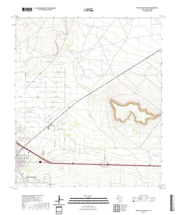
2022 Map of Fort Stockton East
USGS Topo · Published 2022About this map
Fort Stockton anchors the western edge of this West Texas landscape, where the town's expanding residential and industrial grid meets the natural drainage of the Pecos County desert. The prominent course of Comanche Creek winds through the center of the sheet, tracing a path northeast toward Cold Springs. This water system is supplemented by the Highline Ditch, reflecting the long-standing management of water resources in this arid region. The map details a transition from the dense street grid of the town center to larger industrial tracts along Industrial Rd and the Imperial Hwy. On the southeastern outskirts of the settlement, East Hill Cemetery stands as a significant site for local genealogical research, situated near the intersection of several arterial roads including Warnock Rd and Moody Rd.
Find a feature on this map
73 named features on this map. Tap any name to fly to it.
Don’t see what you’re looking for? This feature index may not catch every label — zoom into the map to look around manually.
Map Details
Editions of this 2022 Fort Stockton East Map
This is the sole edition of this map. No revisions or reprints were ever made.
Other maps of this area

1921 · Fort Stockton
USGS Topo · 1:62,500

1923 · Fort Stockton
USGS Topo · 1:62,500

1928 · Comanche Spring
USGS Topo · 1:125,000

1954 · Pecos
USGS Topo · 1:250,000

1954 · Fort Stockton
USGS Topo · 1:250,000

1957 · Pecos
USGS Topo · 1:250,000

1958 · Fort Stockton
USGS Topo · 1:250,000

1970 · Fort Stockton West
USGS Topo · 1:24,000

1970 · Twelvemile Mesa
USGS Topo · 1:24,000

1970 · East Mesa
USGS Topo · 1:24,000