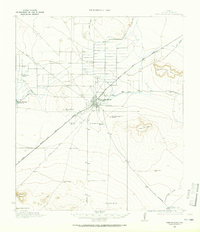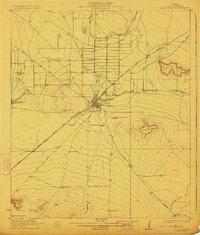
1954 Map of Fort Stockton
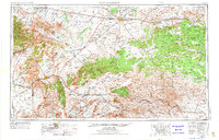
USGS Topo · Published 1974About this map
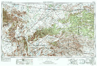
Fort Stockton and the surrounding Trans-Pecos landscape appear here during a period of transition, following a 1973 revision that updated the mid-century 1:250,000 scale survey. The map details the intersection of high desert plateaus and dramatic mountain ranges, including the Davis Mountains and the Glass Mountains. These peaks provided a natural barrier that influenced the path of the Southern Pacific and Atchison Topeka and Santa Fe railroads, which remain critical corridors for West Texas commerce. Regional landmarks such as the Fort Davis National Historic Site and Davis Mountains State Park are documented alongside irrigation-fed water bodies like Leon Lake and Balmorhea Lake. The map reveals a land defined by distance and resource management, where small ranching hubs like Bakersfield and Altuda connect via long stretches of U S 290 and U S 90.
Find a feature on this map
45 named features on this map. Tap any name to fly to it.
Don’t see what you’re looking for? This feature index may not catch every label — zoom into the map to look around manually.
Map Details
Editions of this 1954 Fort Stockton Map
3 editions found

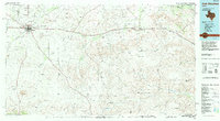
Historical Maps of Fort Stockton Through Time
6 maps found