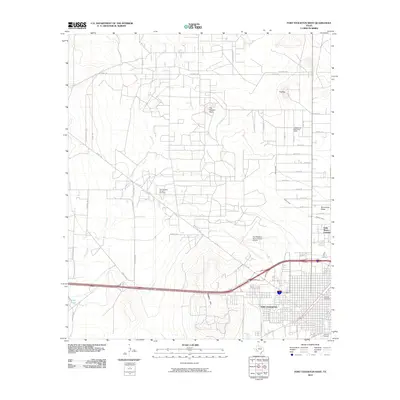
2010 Map of Fort Stockton West
USGS Topo · Published 2010About this map
Old Fort Cemetery and East Hill Cemetery anchor the eastern edge of this landscape, offering a window into the long-standing heritage of Fort Stockton. The 2010 geography reveals a transition from the urban grid of the town to the industrial reaches of the Fort Stockton Oil and Gas Field and the Gomez Oil and Gas Filed to the north.
Find a feature on this map
44 named features on this map. Tap any name to fly to it.
Don’t see what you’re looking for? This feature index may not catch every label — zoom into the map to look around manually.
Map Details
Editions of this 2010 Fort Stockton West Map
This is the sole edition of this map. No revisions or reprints were ever made.
Other maps of this area

1921 · Fort Stockton
USGS Topo · 1:62,500

1923 · Fort Stockton
USGS Topo · 1:62,500

1928 · Comanche Spring
USGS Topo · 1:125,000

1929 · Hovey
USGS Topo · 1:125,000

1931 · Barstow
USGS Topo · 1:125,000

1954 · Pecos
USGS Topo · 1:250,000

1954 · Fort Stockton
USGS Topo · 1:250,000

1957 · Pecos
USGS Topo · 1:250,000

1958 · Fort Stockton
USGS Topo · 1:250,000

1970 · Fort Stockton West
USGS Topo · 1:24,000