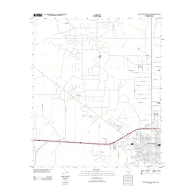
2012 Map of Fort Stockton West
USGS Topo · Published 2012About this map
Fort Stockton serves as the focal point of this Trans-Pecos landscape, where the urban grid of the city meets the industrial expanses of the Permian Basin's southern edge. This era shows a community defined by its crossroads and resources, with the Fort Stockton Oil and Gas Field and Gomez Oil and Gas Field appearing alongside established residential areas like Little Mexico Colonia. The historic water source at Comanche Springs and the nearby Old Ft Cem anchor the town’s origins, while modern infrastructure is represented by the Fort Stockton-Pecos County Airport. Beyond the city limits, the terrain transitions into the distinct topography of Sevenmile Mesa and Twomile Hill, with Leon Cr winding through the western portion of the quadrangle. Smaller settlements and place names like Guild and The Needle Point further define the local geography, illustrating the sparse but vital settlement patterns of Pecos County.
Find a feature on this map
89 named features on this map. Tap any name to fly to it.
Don’t see what you’re looking for? This feature index may not catch every label — zoom into the map to look around manually.
Map Details
Editions of this 2012 Fort Stockton West Map
This is the sole edition of this map. No revisions or reprints were ever made.
Other maps of this area

1921 · Fort Stockton
USGS Topo · 1:62,500

1923 · Fort Stockton
USGS Topo · 1:62,500

1928 · Comanche Spring
USGS Topo · 1:125,000

1929 · Hovey
USGS Topo · 1:125,000

1931 · Barstow
USGS Topo · 1:125,000

1954 · Pecos
USGS Topo · 1:250,000

1954 · Fort Stockton
USGS Topo · 1:250,000

1957 · Pecos
USGS Topo · 1:250,000

1958 · Fort Stockton
USGS Topo · 1:250,000

1970 · Fort Stockton West
USGS Topo · 1:24,000