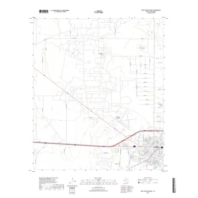
2019 Map of Fort Stockton West
USGS Topo · Published 2019About this map
Fort Stockton serves as the focal point of this West Texas landscape, where the transition from town streets to the high desert terrain of Pecos County is clearly marked. The historical significance of the area is anchored by the Old Fort Cem near the town center and the vital waters of Comanche Springs. The map illustrates a complex network of agricultural and ranching infrastructure, including the Highline Ditch and numerous secondary roads like Leon Farms Rd and W Gomez Rd.
Find a feature on this map
112 named features on this map. Tap any name to fly to it.
Don’t see what you’re looking for? This feature index may not catch every label — zoom into the map to look around manually.
Map Details
Editions of this 2019 Fort Stockton West Map
This is the sole edition of this map. No revisions or reprints were ever made.
Other maps of this area

1921 · Fort Stockton
USGS Topo · 1:62,500

1923 · Fort Stockton
USGS Topo · 1:62,500

1928 · Comanche Spring
USGS Topo · 1:125,000

1929 · Hovey
USGS Topo · 1:125,000

1931 · Barstow
USGS Topo · 1:125,000

1954 · Pecos
USGS Topo · 1:250,000

1954 · Fort Stockton
USGS Topo · 1:250,000

1957 · Pecos
USGS Topo · 1:250,000

1958 · Fort Stockton
USGS Topo · 1:250,000

1970 · Fort Stockton West
USGS Topo · 1:24,000