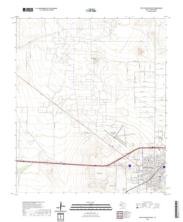
2022 Map of Fort Stockton West
USGS Topo · Published 2022About this map
Fort Stockton serves as the focal point of this Trans-Pecos landscape, where the historic core is defined by the Pecos County Courthouse and the nearby Old Fort Stockton Cem. This modern survey illustrates the persistent importance of water in the arid environment, tracing the path of Comanche Cr and the celebrated Comanche Springs. The high ground is dominated by prominent elevations like Twomile Hill and the distinctive The Needle Point, which stand over a terrain marked by ranching infrastructure and local landmarks such as the Fort Stockton-Pecos County Airport. Farther west, the waters of Lake Leon and the seasonal flow of Leon Cr underscore the region's hydraulic history, while the presence of the Saint Joseph Cem provides a point of interest for genealogists tracking the deep-rooted families of Pecos County.
Find a feature on this map
110 named features on this map. Tap any name to fly to it.
Don’t see what you’re looking for? This feature index may not catch every label — zoom into the map to look around manually.
Map Details
Editions of this 2022 Fort Stockton West Map
This is the sole edition of this map. No revisions or reprints were ever made.
Other maps of this area

1921 · Fort Stockton
USGS Topo · 1:62,500

1923 · Fort Stockton
USGS Topo · 1:62,500

1928 · Comanche Spring
USGS Topo · 1:125,000

1929 · Hovey
USGS Topo · 1:125,000

1931 · Barstow
USGS Topo · 1:125,000

1954 · Pecos
USGS Topo · 1:250,000

1954 · Fort Stockton
USGS Topo · 1:250,000

1957 · Pecos
USGS Topo · 1:250,000

1958 · Fort Stockton
USGS Topo · 1:250,000

1970 · Fort Stockton West
USGS Topo · 1:24,000