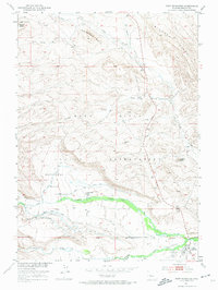
1951 Map of Fort Washakie
USGS Topo · Published 1974About this map
Fort Washakie serves as the focal point of this mid-century landscape within the Wind River Indian Reservation. The mapping records a transition from high-desert ridge lines to irrigated valley floors, most notably around the Countryman Basin and the adjacent Countryman School. The topography is defined by prominent elevations such as Norkok Butte, Sandstone Butte, and the rising slopes of Bighorn Ridge.
Find a feature on this map
23 named features on this map. Tap any name to fly to it.
Don’t see what you’re looking for? This feature index may not catch every label — zoom into the map to look around manually.
Map Details
Editions of this 1951 Fort Washakie Map
3 editions found
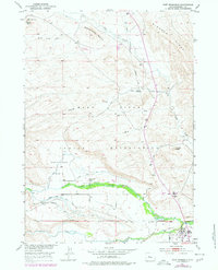
Other maps of this area

1937 · Moccasin Lake
USGS Topo · 1:48,000

1943 · Moccasin Lake
USGS Topo · 1:62,500

1951 · Morton
USGS Topo · 1:24,000

1951 · Fort Washakie
USGS Topo · 1:24,000

1951 · Bull Lake East
USGS Topo · 1:24,000

1951 · Argo Butte
USGS Topo · 1:24,000

1951 · Ethete
USGS Topo · 1:24,000

1952 · Wise Flat
USGS Topo · 1:24,000

1952 · Ray Lake
USGS Topo · 1:24,000

1952 · Wind River
USGS Topo · 1:24,000