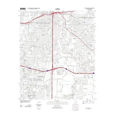
2012 Map of Fort Worth
USGS Topo · Published 2012About this map
Edgecliff Village and the southern residential reaches of Fort Worth are defined by a complex network of interstate loops and historic surface streets as they appeared in the early 21st century. The map highlights the preservation of early 20th-century urban planning through several designated areas, including the Elizabeth Boulevard Historic District and the Fairmount-Southside Historic District. These neighborhoods contrast with the industrial and logistics corridor along the S Fwy, where landmarks like the Fort Worth Rail Mart and Merchants Warehouse Terminal represent the city's role as a major distribution hub.
Find a feature on this map
30 named features on this map. Tap any name to fly to it.
Don’t see what you’re looking for? This feature index may not catch every label — zoom into the map to look around manually.
Map Details
Editions of this 2012 Fort Worth Map
This is the sole edition of this map. No revisions or reprints were ever made.
Other maps of this area

1894 · Fort Worth
USGS Topo · 1:125,000

1931 · Grapevine
USGS Topo · 1:62,500

1954 · Dallas
USGS Topo · 1:250,000

1955 · Haltom City
USGS Topo · 1:24,000

1955 · Burleson
USGS Topo · 1:24,000

1955 · Primrose
USGS Topo · 1:24,000

1955 · Lake Worth
USGS Topo · 1:24,000

1955 · Benbrook
USGS Topo · 1:24,000

1955 · Fort Worth
USGS Topo · 1:24,000

1955 · Haltom City
USGS Topo · 1:62,500