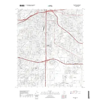
2019 Map of Fort Worth
USGS Topo · Published 2019About this map
Clear Fork Trinity River flows through the western portion of this 2019 survey, framing the urban expansion of southern Fort Worth. The landscape is dominated by a complex web of modern transportation, where the intersection of I-20, I-35w, and Us-287 creates a central hub for the surrounding communities of Forest Hill and Everman. Genealogy researchers will find several notable burial grounds, including the Hebrew Rest Cem and the extensive grounds of Laurel Land Memorial Park. The map documents the residential and industrial infill between established areas like Edgecliff Village and Lytle. Small water bodies like Echo Lake and the winding course of Sycamore Cr provide the primary natural breaks in a landscape otherwise defined by dense street grids and major regional arteries.
Find a feature on this map
21 named features on this map. Tap any name to fly to it.
Don’t see what you’re looking for? This feature index may not catch every label — zoom into the map to look around manually.
Map Details
Editions of this 2019 Fort Worth Map
This is the sole edition of this map. No revisions or reprints were ever made.
Other maps of this area

1894 · Fort Worth
USGS Topo · 1:125,000

1931 · Grapevine
USGS Topo · 1:62,500

1954 · Dallas
USGS Topo · 1:250,000

1955 · Haltom City
USGS Topo · 1:24,000

1955 · Burleson
USGS Topo · 1:24,000

1955 · Primrose
USGS Topo · 1:24,000

1955 · Lake Worth
USGS Topo · 1:24,000

1955 · Benbrook
USGS Topo · 1:24,000

1955 · Fort Worth
USGS Topo · 1:24,000

1955 · Haltom City
USGS Topo · 1:62,500