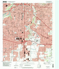
1995 Map of Fort Worth
USGS Topo · Published 2001About this map
Texas Christian University and the Southwestern Baptist Theological Seminary anchor the southern urban landscape of Tarrant County in the mid-1990s. The map captures a high density of educational and social institutions, from the Masonic Home and School and Tarrant County Junior College South Campus to several parochial schools like St Marys Sch. The intersection of industrial and civic life is evident at the Fort Worth Federal Center and the Federal Correctional Institution, while neighborhoods like Edgecliff and Everman show established residential patterns.
Find a feature on this map
74 named features on this map. Tap any name to fly to it.
Don’t see what you’re looking for? This feature index may not catch every label — zoom into the map to look around manually.
Map Details
Editions of this 1995 Fort Worth Map
This is the sole edition of this map. No revisions or reprints were ever made.
Other maps of this area

1894 · Fort Worth
USGS Topo · 1:125,000

1931 · Grapevine
USGS Topo · 1:62,500

1954 · Dallas
USGS Topo · 1:250,000

1955 · Haltom City
USGS Topo · 1:24,000

1955 · Burleson
USGS Topo · 1:24,000

1955 · Primrose
USGS Topo · 1:24,000

1955 · Lake Worth
USGS Topo · 1:24,000

1955 · Benbrook
USGS Topo · 1:24,000

1955 · Fort Worth
USGS Topo · 1:24,000

1955 · Haltom City
USGS Topo · 1:62,500