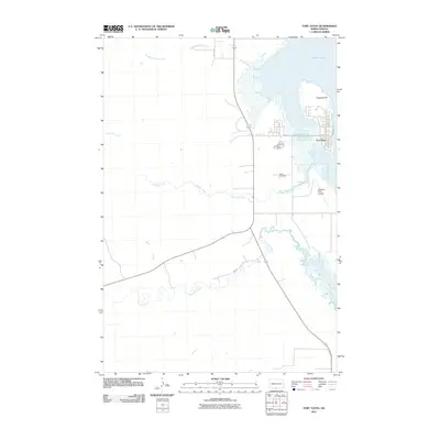
2011 Map of Fort Yates
USGS Topo · Published 2011About this map
Fort Yates serves as the focal point of this Missouri River landscape, showing the town's modern grid and community infrastructure along the western bank. The terrain is defined by a series of tributaries, including Slaughterhouse Creek, Onemile Creek, and Fourmile Creek, which carve through the plains toward the river valley. To the north, Kenel Flats and Proposal Hill mark the local topography, while transportation is facilitated by thoroughfares such as BIA Road 8 and Kenel Rd. Notable local landmarks like the Standing Rock Airport and Reed Cemetery provide touchpoints for local history and genealogists. This 2011 survey illustrates the contemporary layout of the tribal seat and its surrounding Missouri River breaks, documenting the intersection of modern aviation and traditional road networks in Sioux County.
Find a feature on this map
14 named features on this map. Tap any name to fly to it.
Don’t see what you’re looking for? This feature index may not catch every label — zoom into the map to look around manually.
Map Details
Editions of this 2011 Fort Yates Map
This is the sole edition of this map. No revisions or reprints were ever made.
Other maps of this area

1953 · McIntosh
USGS Topo · 1:250,000

1954 · Bismarck
USGS Topo · 1:250,000

1958 · Bismarck
USGS Topo · 1:250,000

1958 · McIntosh
USGS Topo · 1:250,000

1966 · Mahto NE
USGS Topo · 1:24,000

1966 · McLaughlin NE
USGS Topo · 1:24,000

1966 · Mahto NW
USGS Topo · 1:24,000

1968 · Fort Yates NW
USGS Topo · 1:24,000

1968 · Fort Yates SE
USGS Topo · 1:24,000

1968 · Fort Yates
USGS Topo · 1:24,000
Featured Places
- Fort Yates District, ND
- Fort Yates, Fort Yates District
- Kenel District, SD
- Sioux County, ND
- United States