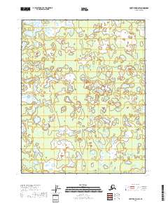
2018 Map of Fort Yukon B-6 SW
USGS Topo · Published 2018About this map
Mud Lakes and the winding course of Fish Cr dominate this section of the interior Alaska wilderness near the Arctic Circle. The landscape is defined by an intricate network of wetlands and shallow water bodies, characteristic of the Yukon Flats region. The presence of numerous unnamed thaw lakes alongside the established Mud Lakes system illustrates the dynamic nature of the permafrost terrain and its seasonal shifts. While human settlements and roads are absent from this 2018 survey, the area is delineated by established township boundaries including t18n r4e and t17n r4e. This map serves as a contemporary record of a remote riverine ecosystem, highlighting the delicate hydrography that has shaped subsistence patterns and geographic navigation in this part of the Yukon-Koyukuk Census Area for generations.
Find a feature on this map
8 named features on this map. Tap any name to fly to it.
Don’t see what you’re looking for? This feature index may not catch every label — zoom into the map to look around manually.
Map Details
Editions of this 2018 Fort Yukon B-6 SW Map
This is the sole edition of this map. No revisions or reprints were ever made.
Other maps of this area

1951 · Fort Yukon
USGS Topo · 1:250,000

1951 · Beaver
USGS Topo · 1:250,000

1956 · Fort Yukon B-6
USGS Topo · 1:63,360
1956 · Beaver A-1
USGS Topo · 1:63,360
1956 · Fort Yukon A-6
USGS Topo · 1:63,360

1956 · Beaver
USGS Topo · 1:250,000

1956 · Beaver B-1
USGS Topo · 1:63,360

1956 · Fort Yukon
USGS Topo · 1:250,000

1964 · Beaver
USGS Topo · 1:250,000
2017 · Beaver B-1 SE
USGS Topo · 1:25,000