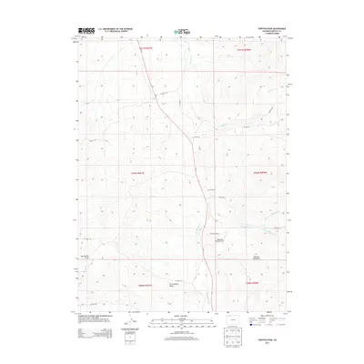
2013 Map of Fortification
USGS Topo · Published 2013About this map
Fortification sits at the junction of several drainage systems in northwestern Colorado, where the Co-13 highway follows the narrow valley floor. The landscape is defined by the convergence of the N Fork Fortification Cr and S Fork Fortification Cr, creating a vital water source in this arid terrain. To the south, the Fortification Rocks stand as a distinctive geological landmark, while the eastern edge of the quadrangle rises toward the Elkhead Mountains. Ranching remains the primary human imprint on the land, evidenced by the Mesa View Ranch and its associated Mesa View Ranch Airport. The mapping of various county roads, including CO Road 109 and CO Road 117, shows how the region is networked through its draws and creek beds, such as Mud Spring Draw and Fourmile Cr, which likely served as historic pathways through the high-elevation basins.
Find a feature on this map
25 named features on this map. Tap any name to fly to it.
Don’t see what you’re looking for? This feature index may not catch every label — zoom into the map to look around manually.
Map Details
Editions of this 2013 Fortification Map
This is the sole edition of this map. No revisions or reprints were ever made.
Other maps of this area

1916 · Craig
USGS Topo · 1:125,000

1923 · Elkhead Creek
USGS Topo · 1:62,500

1924 · Elkhead Creek
USGS Topo · 1:62,500

1954 · Craig
USGS Topo · 1:250,000

1957 · Craig
USGS Topo · 1:250,000

1958 · Craig
USGS Topo · 1:250,000

1960 · Craig
USGS Topo · 1:250,000

1962 · Craig
USGS Topo · 1:250,000

1964 · Craig
USGS Topo · 1:250,000

1965 · Craig
USGS Topo · 1:250,000