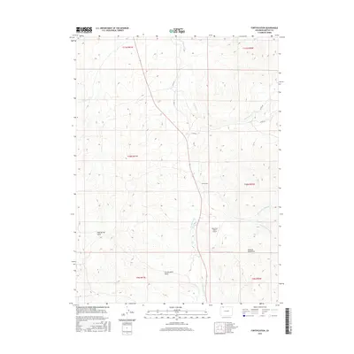
2016 Map of Fortification
USGS Topo · Published 2016About this map
Fortification sits at the heart of this high-plains landscape in Moffat County, where the topography is defined by the drainage systems of Fortification Cr and its tributaries. The settlement is positioned along a north-south transit corridor that follows the creek valley, flanked to the west by the distinct formations of Fortification Rocks and to the east by the rising slopes of the Elkhead Mountains. The land use here reflects a ranching and aviation footprint, notably represented by the Mesa View Ranch Airport situated on a plateau above the creek. A network of county roads, including Co RD 101 and Co RD 38, provides access to the surrounding draws and mesas. The map detail highlights the hydrological complexity of the area, tracing the N Fork Fortification Cr and S Fork Fortification Cr as they converge toward the main valley floor.
Find a feature on this map
19 named features on this map. Tap any name to fly to it.
Don’t see what you’re looking for? This feature index may not catch every label — zoom into the map to look around manually.
Map Details
Editions of this 2016 Fortification Map
This is the sole edition of this map. No revisions or reprints were ever made.
Other maps of this area

1916 · Craig
USGS Topo · 1:125,000

1923 · Elkhead Creek
USGS Topo · 1:62,500

1924 · Elkhead Creek
USGS Topo · 1:62,500

1954 · Craig
USGS Topo · 1:250,000

1957 · Craig
USGS Topo · 1:250,000

1958 · Craig
USGS Topo · 1:250,000

1960 · Craig
USGS Topo · 1:250,000

1962 · Craig
USGS Topo · 1:250,000

1964 · Craig
USGS Topo · 1:250,000

1965 · Craig
USGS Topo · 1:250,000