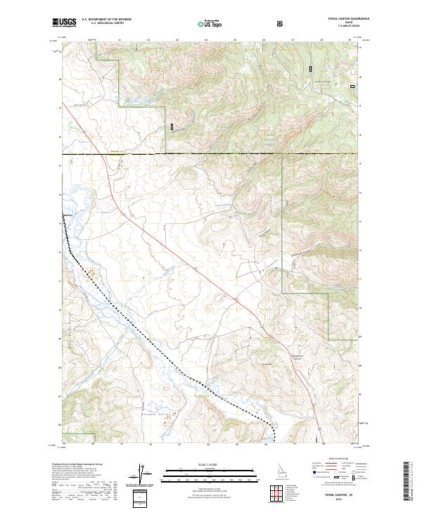
2023 Map of Fossil Canyon
USGS Topo · Published 2023About this map
The Bear River meanders through the high valley of southeastern Idaho, carving a wide path between the Bear River Range and the Aspen Range. This landscape is defined by the transition from the irrigated agricultural lands of Nounan Valley and Manson to the steep, canyon-cut slopes of the Caribou National Forest. The presence of Swan Lake Reservoir and Cranes Reservoir highlights the importance of water management in this high-altitude environment, where mountain runoff is captured for the valley floor.
Find a feature on this map
31 named features on this map. Tap any name to fly to it.
Don’t see what you’re looking for? This feature index may not catch every label — zoom into the map to look around manually.
Map Details
Editions of this 2023 Fossil Canyon Map
This is the sole edition of this map. No revisions or reprints were ever made.
Other maps of this area

1909 · Montpelier
USGS Topo · 1:125,000

1911 · Montpelier
USGS Topo · 1:125,000

1911 · Slug Creek
USGS Topo · 1:62,500

1915 · Preston
USGS Topo · 1:96,000

1918 · Preston
USGS Topo · 1:125,000

1948 · Soda Springs
USGS Topo · 1:62,500

1949 · Soda Springs
USGS Topo · 1:62,500

1949 · Johnson Creek
USGS Topo · 1:24,000

1949 · Dry Valley
USGS Topo · 1:24,000
1951 · Dry Valley
USGS Topo · 1:24,000