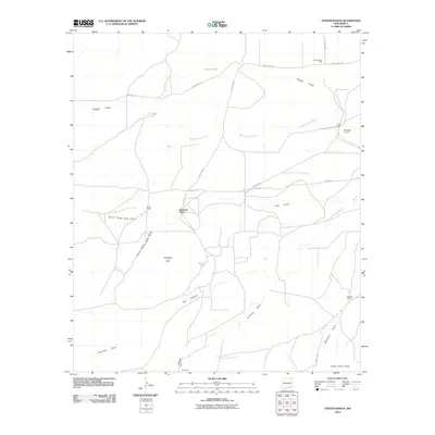
2010 Map of Foster Ranch
USGS Topo · Published 2010About this map
Foster Ranch and Knowles Place anchor this landscape of the northern Chihuahuan Desert in Eddy County, where a complex network of ephemeral drainage patterns defines the land use. The map illustrates a ranching economy dependent on water management, evidenced by numerous tanks such as Horner Tank, C C Tank, and Round Tank. This reliance on collected water is necessitated by the seasonal nature of the local hydrology, which includes the Middle Seven Rivers and the South Seven Rivers.
Find a feature on this map
28 named features on this map. Tap any name to fly to it.
Don’t see what you’re looking for? This feature index may not catch every label — zoom into the map to look around manually.
Map Details
Editions of this 2010 Foster Ranch Map
This is the sole edition of this map. No revisions or reprints were ever made.
Other maps of this area

1940 · Bandanna Point
USGS Topo · 1:62,500

1943 · Bandanna Point
USGS Topo · 1:62,500

1943 · West Carlsbad
USGS Topo · 1:62,500

1945 · West Carlsbad
USGS Topo · 1:62,500

1954 · Seven Rivers
USGS Topo · 1:24,000

1954 · Carlsbad
USGS Topo · 1:250,000

1955 · Dayton
USGS Topo · 1:24,000

1956 · Parish Ranch
USGS Topo · 1:24,000

1956 · Antelope Sink
USGS Topo · 1:24,000

1957 · Foster Ranch
USGS Topo · 1:24,000